|
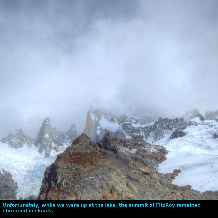
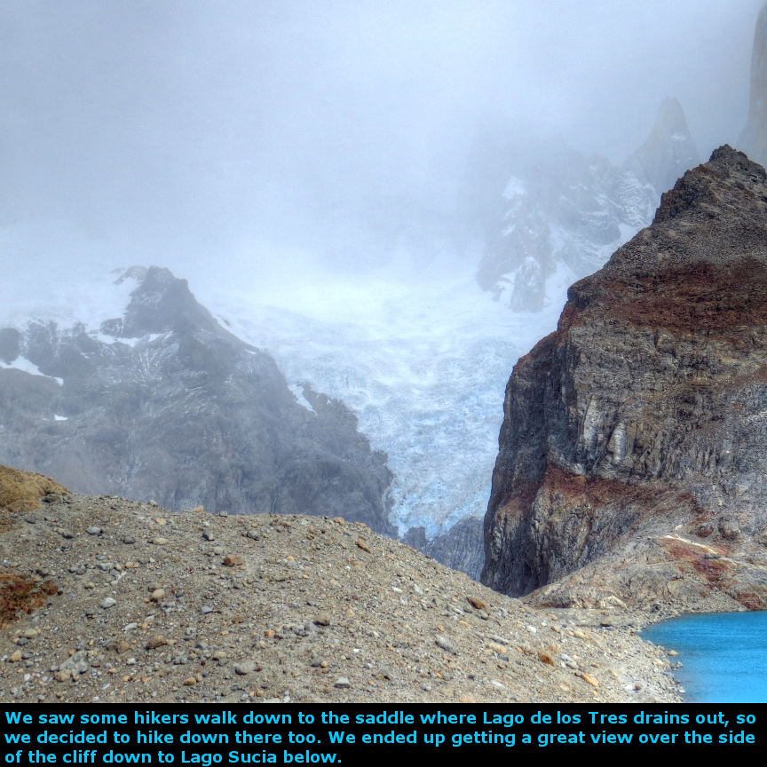
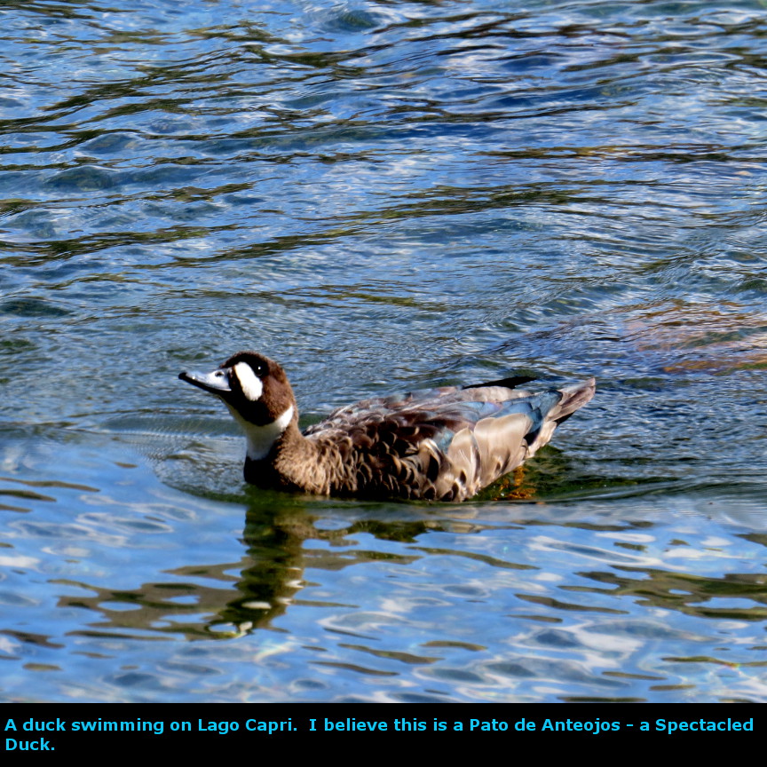
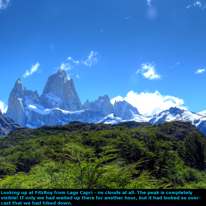
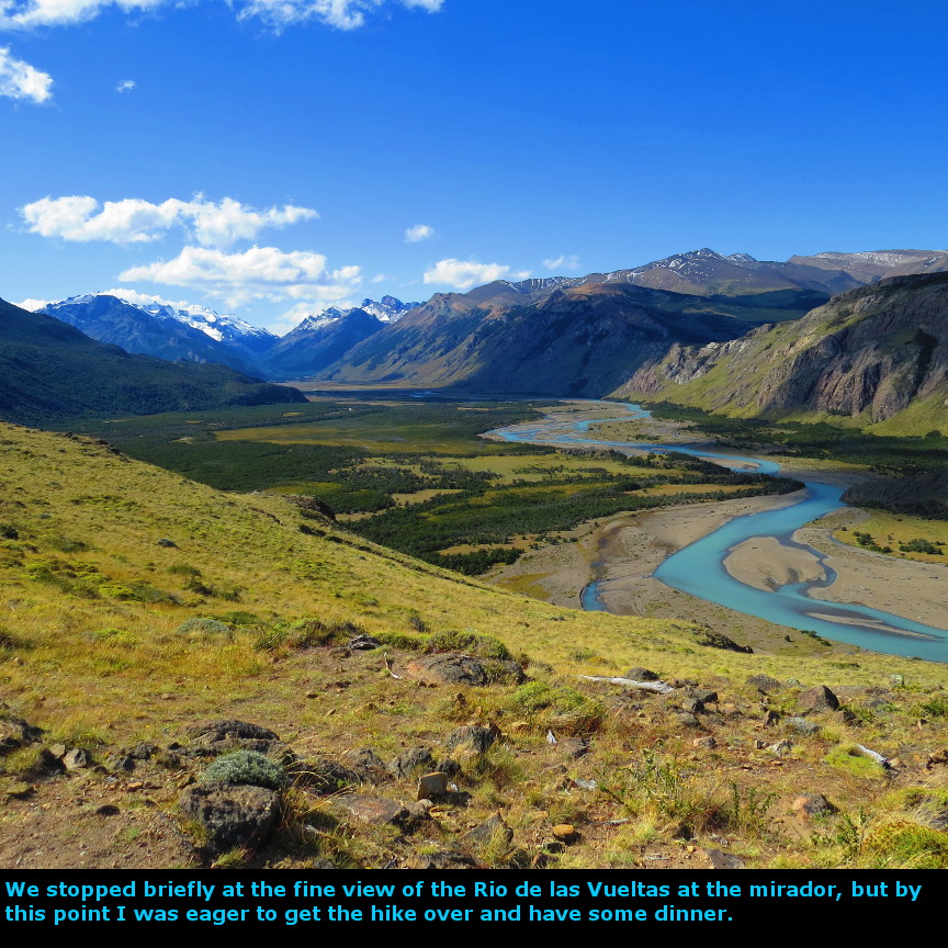
Today we did the most famous hike from El Chaltén: the hike up to Lago de los Tres, the picturesque lake that nestles at the base of Mount FitzRoy. It is famously scenic, but it requires a tough climb to get up to the ridge that overlooks the lake. It was a dismal day at the start, with rain coming down steadily. The previous evening, we paid 100 pesos each for an 8 A.M. morning van ride to Hosteria El Pilar, the traditional starting point for the 22 km hike. We rode in a 13 person van to the start, I believe the other van riders were all part of a guided trip, possibly they were going to hike the same route as us. It was a short 11 km ride out to the Hosteria - everybody disembarked from the van and began hiking at about 8:45 A.M. The rain kept falling but after the first mile or two it lessened, and then ceased entirely. By the time we reached the glacier view point, the rain done for the day. The first viewpoint is Mirador Piedras Blancas, which gives a nice straight-on view of the Piedras Blancos glacier. There is a lake at the base of the glacier -this drains into the Rio Blancos. After the viewpoint, we soon reached Camp Poincenot. The trail up to this point had all been easy hiking over relatively flat terrain. But from Camp Poincenot up Lago de los Tres has an elevation gain of several hundred meters up a steep slope. There was a sign at the bottom saying it would take an hour to reach the crest, but it took us an hour and fifteen minutes. It was windy and cold at the top, but the conditions were not intolerable. We ate a bit of lunch and looked at the lake. Unfortunately, FitzRoy itself was shrouded in clouds, so we didn't get the iconic view that I was hoping for. We noticed that a good number of hikers went down the ridge toward Lago de los Tres, and then went off to the left - so we hiked down there too. I was glad we did, because it leads to a stunning view - the outflow of Lago de los Tres pours down a cliff to Lago Sucia far below. We could see the Rio Blanco Glacier. After some pictures, we returned to the ridge that looks down on Lago de los Tres. It appeared that the clouds were even thicker, and descending further, so I assumed that they would not lift all day, so we headed back down the steep slope to Camp Poincenot. When we stopped at Camp Poincenot and looked back, the sky had cleared and most of the clouds were gone! If it wasn't such a difficult climb, I would have gone back up to the lake. On our hike back to El Chaltén, we took the branch of the trail that leads to Lago Capri. The shore of this lake has a campground, with some excellent views of the surrounding mountains, including FitzRoy. It was downhill all the way to El Chaltén, and we covered the distance easily. After a rainy morning, the afternoon had turned into a warm sunny day. By 5 PM we were back in town and ready for dinner. Panorama Photos


MapsThe map of our hike to Lago de los Tres 
VideosIf you do not see the videos, but instead see a message that says: "Error: Video playback aborted" it is possible that the content is being blocked by your web browser. You may see a message at the top or bottom of your page that says "restricted webpage from running scripts or ActiveX controls". If you see that message, click on the ALLOW BLOCKED CONTENT box and that should allow these videos to run.
To display the photo images on this webpage, I am using a freely distributed java script called Lightbox v2.7.1 written by Lokesh Dhakar. You can download this program by clicking on this link. All the text and photographs on this webpage are my own creation, but the textured background is taken from a site, EOS development, that offers non-profit users free use of their graphics. Click the icon below to visit their site.
|
Click on any thumbnail to begin the slide show at that photograph FitzRoy Photos


|